RECENT NEWS STORIES

GPR Survey on Drumkeeran Cemetery

On Wednesday, 15th May,
a GPR survey was carried out on sections of Drumkeeran cemetery.
The purpose of the survey is to ascertain whether or not burials have taken place
in
various sections of the cemetery.
This information will be very useful as we try to establish the number of available plots.

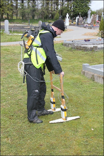
The surveyors use a technology known as Ground Penetrating Radar.
As the walk along
the surface radio waves are beamed into the ground.
The radio waves show an echo whenever
a burial is encountered.

As each section was surveyed, the ground was mark with colour coded flags.
Red flags
indicate that no burial has taken place.
Green flags indicate that a burial has taken
place.
Yellow flags indicate that the earth has been disturbed
and that a burial may
have taken place.
The only areas surveyed were those where there are no headstones,
no references to
burials on our old cemetery map
and no physical indications of a grave.
Plots that are known to be graves were not surveyed.
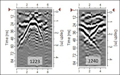
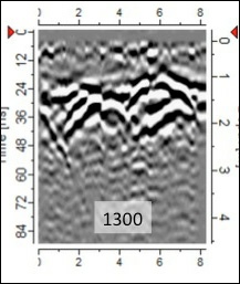
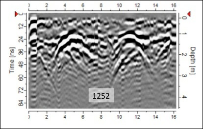
The images below give an example of the results of the GPR survey.
The presence of
a burial is indicated by the hyperbolic curve in the image.

The pattern in Image 1223 shows a very definite burial.
The confused pattern in Image
1240 shows that the soil has been disturbed
but it’s not clear whether or not a burial
took place.

The pattern in image 1300 indicates that a number of burials have taken place in this plot.

Image 1252 shows that two burials, side-